Your title plan does not show your legal boundary — it shows a red line on an Ordnance Survey map, drawn under the general boundaries rule, and the courts have just reminded everyone what that means. This guide explains how the exact line is actually fixed, who owns which fence, why there is no 7-year boundary rule, what a dispute genuinely costs, and what Clapham v Narga and Brown v Ridley changed for anyone arguing over a strip of land.
On This Page
Property Boundaries: What the Title Plan Does and Does Not Tell You
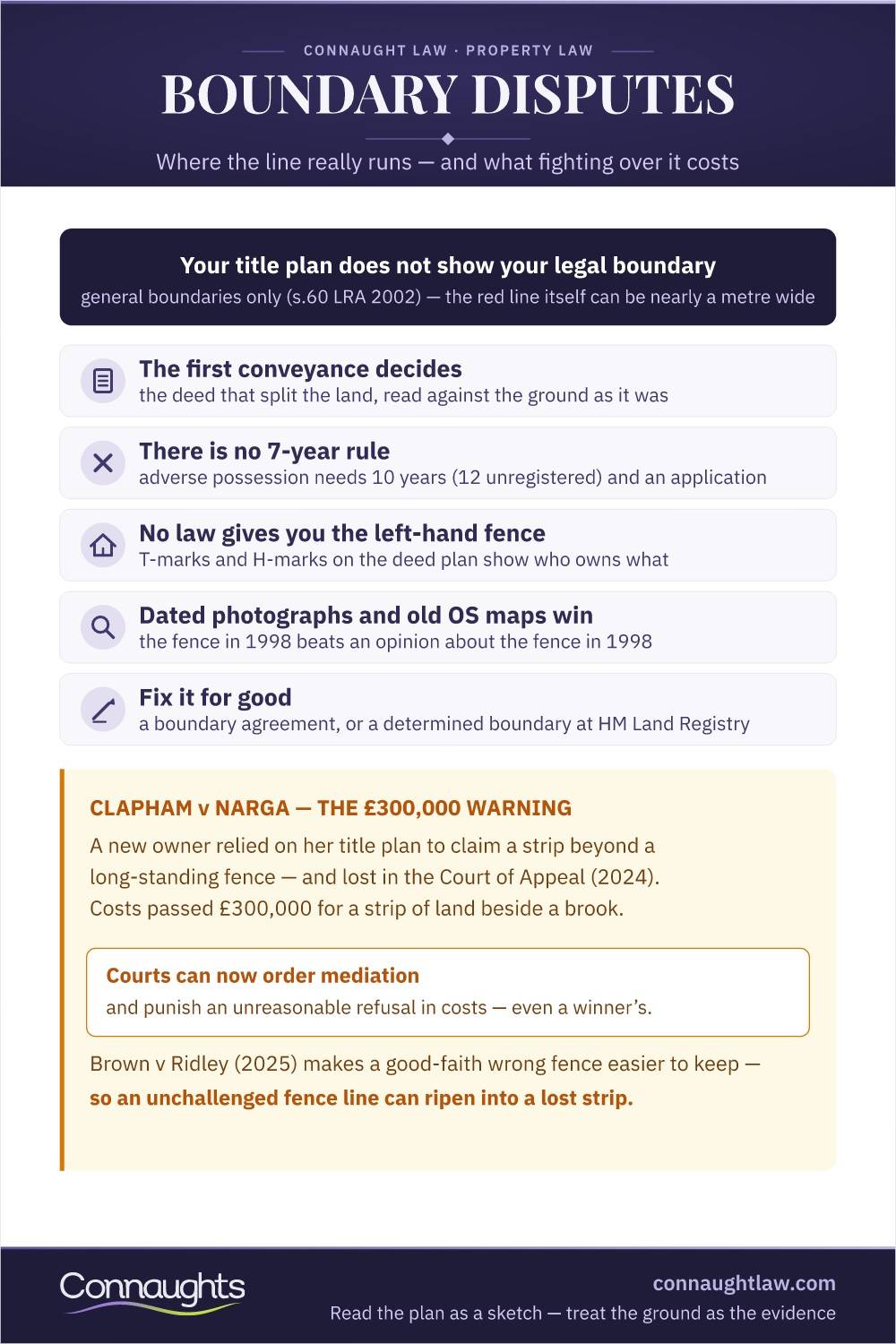
Under section 60 of the Land Registration Act 2002, a registered title plan shows general boundaries only — the red line indicates roughly where the property sits on the Ordnance Survey map, and it deliberately does not determine the exact line. At the scale most plans use, the width of the red line itself can represent close to a metre on the ground. The exact legal boundary exists, but it lives in the deeds, the history and the ground — not in the plan people wave at their neighbours.
That single misunderstanding starts most boundary disputes: someone reads a title plan as a survey, measures from it, and demands a fence move. The government's own guidance says what every judge says — the plan is the beginning of the inquiry, never the end of it.
The Legal Boundary: Fixed by Deeds, Not by Fences
The exact line was fixed the day the land was first divided: the conveyance or transfer that split one plot into two is the governing document, and everything since is interpretation. Where its words and plan are unclear — "for identification purposes only" appears on most — the law construes them in the light of the physical features that existed on the ground at the date of the split, which is why old photographs and Ordnance Survey editions decide modern arguments.
How Courts Decide Where the Line Runs
The hierarchy is consistent: first the parting conveyance, construed against the ground as it then was; then the legal presumptions where the documents are silent; then what the parties have done since — boundary agreements, long acquiescence, estoppel, and adverse possession where its strict conditions are met. Later title plans rank low. The neighbour who arrives with the first conveyance and a dated photograph beats the neighbour who arrives with a printout and a tape measure.
Fences, Hedges and Walls: Ownership Myths
There is no law giving you the left-hand fence. Ownership of a boundary structure comes from the deeds — T-marks on a deed plan indicate ownership and repairing responsibility, an H-mark (two joined Ts) indicates a party structure — and where the deeds are silent, from the presumptions below or simply from who built and maintained it. Nor does owning a fence oblige you to keep it beautiful, or entitle your neighbour to paint their side of it without consent: it remains your structure on your land.
The Presumptions: Hedge and Ditch and Friends
- Hedge and ditch: where a hedge stands beside a man-made ditch, the boundary is presumed to run along the far edge of the ditch — the digger dug at their limit and threw the soil back onto their own land
- Highways: adjoining owners are presumed to own to the middle line of the road, subject to the highway rights over it
- Non-tidal rivers and streams: ownership to the centre of the watercourse
- Party walls: walls dividing buildings are presumed shared, with the Party Wall etc. Act 1996 governing works to them
- All rebuttable: every presumption gives way to what the deeds actually say
Above and Below: The Boundary Is Three-Dimensional
A boundary is a plane, not a line. Overhanging branches, gutters and crane jibs trespass into your airspace at the height ordinary use reaches; tree roots trespass beneath. Flats stack horizontal boundaries — floor, ceiling, structural walls — defined by the lease rather than any plan. The practical rule: anything of your neighbour's crossing the plane, above or below ground, is actionable, but the remedy is usually abatement or agreement rather than a writ.
Basements, Excavations and the Right of Support
Land carries a natural right of support from its neighbour: excavate carelessly beside the line and the subsidence is your liability. The Party Wall etc. Act 1996 adds a notice regime — works to a shared wall, or excavation within three metres (six for deep foundations) of a neighbouring building, require notice and, in dispute, a surveyors' award. Basement projects that skip the notices buy themselves an injunction risk that costs more than the surveyors ever would.
Is There a 7-Year Boundary Rule?
No. The "7-year boundary rule" is a persistent myth — no law transfers land because a fence has stood for seven years. What exists are doctrines with different numbers: adverse possession, which needs at least 10 years' exclusive possession of registered land (12 for unregistered) and a successful application; boundary agreements, which bind from the day they are made; and estoppel, which turns on conduct rather than any fixed period. A neighbour citing the seven-year rule is negotiating, not stating law.
The related question — is there a time limit on boundary disputes? — has an equally unhelpful answer: no limitation period applies to establishing where a boundary runs, and a continuing trespass renews daily. What changes with delay is the evidence: fences move, witnesses go, photographs fade into undated piles. The practical time limit is how long the proof survives, which is why a dispute is best confronted while the evidence is fresh.
What a Boundary Dispute Really Costs
Contested boundary litigation routinely runs to six figures — Clapham v Narga, below, passed £300,000 in costs over a strip beside a brook — and judges say openly that these fights are economically irrational. Costs regularly exceed the value of the disputed land many times over, insurance rarely covers them, and since the courts gained the power to order mediation, an unreasonable refusal to negotiate is punished in costs even by a winner. The first professional question in any boundary dispute is not "can we win?" but "what is this strip worth, and what will winning cost?"
The Evidence That Wins
- The first conveyance: the document that divided the land, with its original plan
- Historic mapping: old Ordnance Survey editions and aerial photography showing features at the date of division
- Dated photographs: the fence in 1998 beats an opinion about the fence in 1998
- T-marks and H-marks: deed-plan markings for ownership and shared structures
- An expert surveyor: a boundary specialist working to recognised surveying standards, not a general valuer
- Long-residence witnesses: statements from those who remember the ground, taken before memories fade
Why Boundary Disputes Arise Where They Do
The trigger is almost never the line itself — it is what someone wants to do on it. Urban disputes cluster around extensions, driveways and side returns, where centimetres decide whether a project fits. Rural disputes follow development value: a hedge nobody measured for a century becomes contentious the day a paddock gets planning potential. And sales ignite them, because buyers' solicitors ask the questions neighbours spent decades not asking. The pattern points to the prevention: fix the line before the works, the sale or the planning application — not after.
Recent Cases: The Law Moved, in Both Directions
In Brown v Ridley [2025] UKSC 7, the Supreme Court eased the path for adverse possession claims based on boundary mistakes: the required reasonable belief that the land was theirs need only cover ten years, not run right up to the application date. For anyone who has occupied up to a misplaced fence in good faith, the route to registration is now more forgiving — and for the paper owner, the case is a warning that a wrong fence line left unchallenged can ripen into a lost strip.
Clapham v Narga: The £300,000 Warning
In Clapham v Narga [2024] EWCA Civ 1388, a new owner relied on her registered title plan to claim a strip beyond a long-standing fence line — and lost. The Court of Appeal reaffirmed that title plans show general boundaries only, and that adverse possession completed before first registration had already fixed the line at the fence. Costs exceeded £300,000, for a strip of land beside a brook. Read the title plan as a sketch, treat the ground as the evidence, and price mediation as the bargain it is.
Mediation Orders and Determined Boundaries
Two procedural tools now do what litigation used to. Since the courts' post-Churchill powers took effect in October 2024, judges can order the parties into mediation and penalise unreasonable refusal in costs. And where the parties want the line fixed for good, a determined boundary application to HM Land Registry — supported by a surveyor's plan to exact tolerances — converts the general boundary into a precise, registered one without a trial. Between them, they make the six-figure boundary case a choice rather than a fate.
Frequently askedQuestions about property boundaries
What is a property boundary in law?
The invisible plane dividing one ownership from the next — fixed by the conveyance that first split the land, not by the title plan, which shows general boundaries only. The fence merely marks where someone once thought the line ran; the deeds and the ground's history say where it actually does.
Who owns which fence?
Whatever the deeds say — there is no left-hand-fence law. T-marks on a deed plan show ownership and repair responsibility; an H-mark shows a shared structure. Where deeds are silent, presumptions and maintenance history fill the gap, and many garden fences turn out to be shared or of unknown ownership.
Is there a 7-year boundary rule?
No — it is a myth. Nothing transfers land at seven years. Adverse possession of registered land needs at least ten years' exclusive possession plus a successful Land Registry application, and Brown v Ridley (2025) confirmed the reasonable-belief requirement covers any ten-year period. Seven years has never been the number.
Is there a time limit on boundary disputes?
No limitation period applies to establishing where the line runs, and a continuing trespass renews daily. The real deadline is evidential: photographs, witnesses and old fence lines degrade with every year, so the dispute is best confronted while the proof still exists.
What does a boundary dispute cost?
Contested litigation routinely reaches six figures — Clapham v Narga passed £300,000 over a strip beside a brook — and usually exceeds the land's value many times over. Mediation, a boundary agreement or a determined boundary application costs a fraction of that, which is why courts now push parties there and punish refusal in costs.
How do I fix my exact boundary permanently?
Agree it with your neighbour and record it — a written boundary agreement, or a determined boundary application to HM Land Registry supported by a specialist surveyor's plan. Once determined, the boundary is exact and registered, and the argument is closed for every future owner on both sides.
Tell us what the deeds say, what stands on the ground and what triggered the disagreement. We will tell you where the evidence points, what the strip is really worth fighting for, and the cheapest route to fixing the line for good.
Get Expert Advice